







All Navigation articles
View all stories of the same content type.
-
 Navigation
SmartSail targets marine navigation with aviation-inspired approach
California start-up aims to bring aviation-style route planning and data integration to recreational boating using existing onboard electronics
-
 Navigation
Rocket Lab acquires Iridium
Well known in marine communications, US-based Iridium has been acquired by Rocket Lab in an US$ 8bn deal to create a vertically-integrated space entity
-
 Navigation
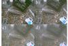
New underwater mapping system ‘sees’ through murky water
A mapping technique developed at MIT combines a dolphin’s echo-location ability with the close-range vision of a sea turtle to penetrate even the murkiest water
-
 Navigation
Munich satellite navigation summit
For anyone with a stake in satellite navigation, there will be a space tech conference held in Munich from March 23-27, 2026, to explore the latest innovations
-
 Navigation
Sat nav disruption explained
The phrase ‘Jamming makes it die and spoofing makes it lie’ is explained in a new free publication by the Nautical Institute about satellite disruption
-
 Navigation
Daniamant 3D new forward-looking sonar
Described as an ‘industry first’, the new single transducer for the Daniamant FLS 3D offers 30 degrees of 3D horizontal sonar imaging in real time.
-
-
 Navigation
Three-day navigation event – 22-24 October
A special three-day event, which can be viewed online, will bring together researchers and academia to discover the latest advances in PNT satellite navigation
-
 Navigation
Quantum technology for next generation navigation
With hostile powers able to jam the Global Navigation Satellite System (GNSS), quantum technology could provide a dependable alternative
-
 Navigation
Better sensor perception for radar
A strategic partnership between Navtech Radar and machine learning specialists Tocaro Blue has greatly improved target identification for W-band scanners
-
 Navigation
Galileo High Accuracy Service gives position to within 20 centimetres
A group of Canadian scientists has been the first to use the European Galileo HAS positioning system to survey parts of Antarctica in minute detail
-
-
 Navigation
May launch scheduled for new GPS III satellite
The US military’s Space Force plans to launch the next GPS III satellite in late May to demonstrate how it can fill constellation gaps on a truncated timetable
-
-
-
 Navigation
Saildrone adapted to operate in ‘GPS denied’ areas.
The rising tensions in disputed seas of the world have led to GPS signals being deliberately jammed or spoofed, but Saildrone has found a workaround.
-
 Navigation
MARELEC discusses a world without GPS
The 13th Marine Electromagnetic Conference (MARELEC) has just closed in Southampton, and a key discussion point was how to navigate if GPS is lost.
-

-
 Navigation
New satellite offers safer Arctic navigation
The Sentinel-1C satellite due for launch of 4 December will provide continuous data and Galileo gps integration for highly accurate navigation and ice thickness warnings
-
 Navigation
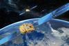
Galileo satellites offer 18cm accuracy for the maritime sector
EU seeking to roll out a GPS accuracy measured in centimetres
 LinkedIn
 X / Twitter
 Facebook
 Email us